Geospatial Intelligence

Precision tools built
for the field

GeoSmart Solutions designs and builds geospatial applications for wildlife conservation, forest management, and field operations — where every coordinate matters.

See Our Work Get in Touch
Scroll

Where geography meets
ground-level intelligence

GeoSmart Solutions is a technology company specialising in geospatial software for conservation and field operations. We build tools that work in the real world — offline-capable, precise, and built for the people who use them.

Our work spans Android field applications, real-time web dashboards, and geo-tagged evidence systems — all tightly integrated so that data collected on the ground is instantly visible to leadership.

We work closely with forest departments, wildlife wardens, and range officers to understand the demands of field work and design accordingly.

3+
Deployed field applications
716
Field officers tracked in real time
GPS
Precise location on every data point
v1.0
Live in production today

Built for every layer
of the operation

From officer-facing mobile apps to supervisor dashboards — we cover the full stack of field intelligence.

Mobile Field Apps

Offline-capable Android applications for patrol tracking, wildlife sighting records, and geo-tagged photography in areas with no connectivity.

Live Monitoring Dashboards

Real-time web dashboards that display officer positions, patrol coverage, and field activity — giving leadership a complete operational picture.

Geospatial Data Systems

GPS-stamped data pipelines that embed coordinates, altitude, and accuracy into every field record — ensuring precise, verifiable evidence.

Patrol Analytics

Monthly performance reports, beat-level summaries, and track playback tools — turning raw patrol data into actionable insights for management.

Projects in production

Three integrated tools, deployed together for a major Indian forest department.

Android App

WildTrack

Wildlife Patrol Tracking System
WildTrack app screenshot

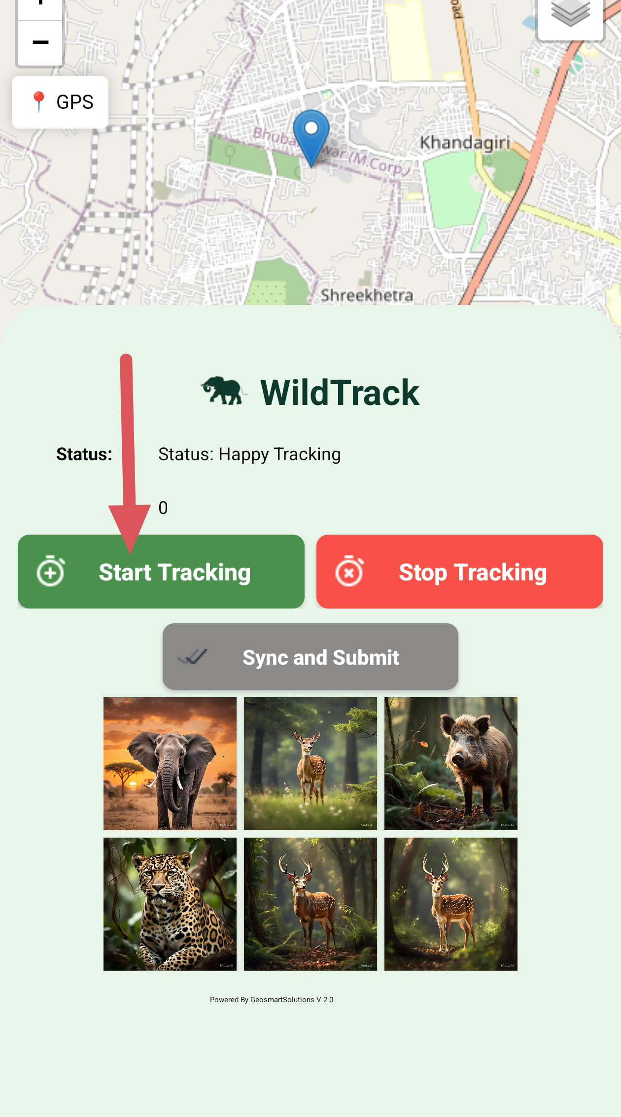
A field data collection system for forest rangers and beat officers. Records patrol routes, GPS tracks, and wildlife sightings in real time — even without network connectivity. Data syncs automatically to the dashboard when a connection is available.

GPS Tracking Offline-Capable Wildlife Sightings
Web Dashboard

WildTrack Dashboard

Field Monitoring Command Centre
WildTrack Dashboard live map

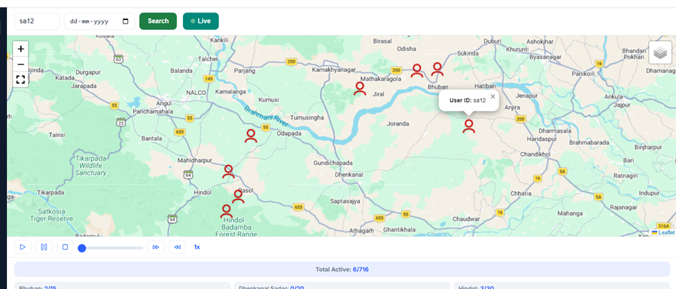
A real-time monitoring dashboard for range officers and senior staff. Tracks live positions of all field officers across the range, records patrol activity, maps wildlife sightings, and consolidates geo-tagged camera evidence.

Live Tracking Track Playback Reports
Android App

Forest Cam

Field Photography Application
ForestCam geo-tagged evidence

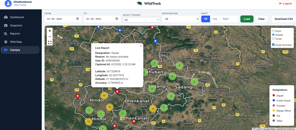
A field photography app for forest officers. Every photograph is automatically stamped with precise GPS coordinates, altitude, and accuracy at the moment of capture. Officers add remarks and share evidence instantly via WhatsApp.

Geo-Tagged Photos Instant Sharing Evidence Logging

Let's build something
for the field

Whether you're a forest department, wildlife reserve, or conservation organisation — we'd love to hear about your operational challenges and explore how geospatial technology can help.

contact@geosmartsolutions.in
geosmartsolutions.in